“Ground-truthing” underway on Butterfield Overland National Trail
BY SHEILA HARRIS [email protected]
After a feasibility study conducted some 20 years ago, the 1858 Butterfield Overland Mail Route was designated a National Historic Trail (NHT) by the U.S. National Park Service (NPS) on Jan. 5, 2023.
The NPS is now performing boots-on-the-ground scouting of the trail’s historic 3,292-mile route, some 40 miles of which pass through Barry County, north to south.
Angelica Sanchez-Clark, with the Historic Trails Office of the NPS, calls her office’s reconnaissance mission “Groundtruthing,” Members of her team, based in Santa Fe, N.M., passed through Barry County the second week in November, making only a brief pit-stop in Cassville. However, Sanchez-Clark said she hopes to meet with city, county and state planners, as well as private property owners, located along the historic trail in the near future.
“We’re working on a plan for the development of the Butterfield NHT,” Sanchez-Clark said. “We want to encourage city planners and private property owners to think about the historic trail in their backyards, and present them with information about ways they can partner with the NPS to preserve and promote their section of the national trail.”
The Butterfield’s route through the center of Cassville – and its overlap with the infamous “Cherokee Trail of Tears” and the Civil War’s Telegraph Road, known locally as “The Old Wire Road” — puts the city in a prime position to take advantage of the NPS’s promotional assistance.
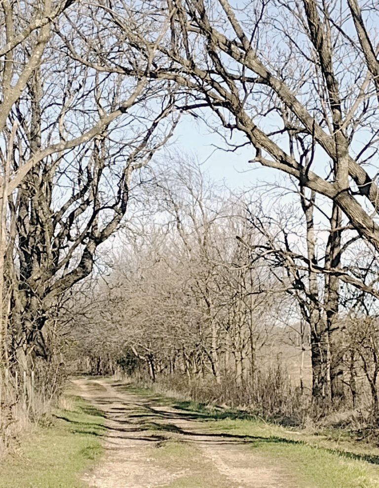
Visible remnants of the original trail are of particular importance to the NPS, said Sanchez-Clark. Aside from segments in national parks, such as in Wilson’s Creek and at Pea Ridge National Battlefield, most visible remnants of the trail exist on private property.
A trail segment is clearly visible from the public farm road (on gated private property), about a half-mile northeast of Madry Christian Union Church on Highway 39, in eastern Barry County.
According to Barry County history, Civil War troops forded Flat Creek a total of 13 times en route from McDowell to Cassville, so it’s likely that intact remnants of the trail still exist on private properties alongside the creek. Such remnants are part of local – and now national – history.
“The plan is to present a vision for how the public can interact with the remnants and stories of the trail and [learn] the important role [the trail] played in American history,” the NPS’s website said (https://tinyurl.com/ czwv23tv).
Sanchez-Clark said it’s important to her office, which oversees 10 national trails, to be historically accurate when developing the Butterfield trail. With that in mind, the NPS has contracted with Logan-Simpson Environmental Services to conduct Light Detection and Ranging (LIDAR) research of the trail’s 3,000-plus miles. With the relatively new laser LIDAR technology, impressions in the earth — including wagon wheel swales — can be detected.
Sanchez-Clark emphasizes that the NPS operates solely in an administrative capacity.
“We don’t manage anybody’s land, nor do we own any of the land along the trail,” she said.
Partnership with the NPS doesn’t obligate any landowner to follow the suggestions presented in the development plan, the NPS’s website said.
“We’re just available for free technical support for promotion and, possibly, financial support for preservation,” Sanchez-Clark said.
Sites must first be certified as being worthy of interest, the NPS’s website said. Partnership with the NPS, Sanchez-Clark said, involves the ability of the NPS to provide resources, including funding for preservation, signage at no charge, and trail-marker listings on the NPS website for parties interested in partnering.
Signage can include a single sign, directive signs or wayside interpretive display markers.
John Butterfield’s ambitious 3,292-mile overland mail route was originally approved by the federal government in 1857 and began operation in 1858. Favored for its sweeping “ox-bow curve” through seven southern states, which steered clear of high mountain passes, Butterfield’s original mail route ran for only three short years before the Civil War curtailed its operation.
The Butterfield Overland Mail Route — newly designated as the “Butterfield Overland NHT” — began its land route in Tipton and terminated in San Francisco, Calif.
From Tipton, in Missouri, the route meandered mostly south and a bit to the west, where it passed through Springfield, then continued southwesterly through bits of Christian and Stone Counties, before descending through Barry County.
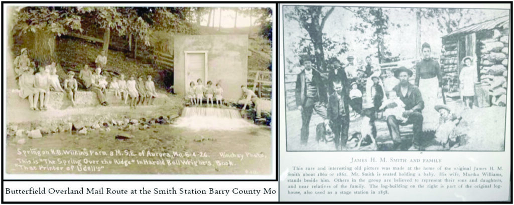
The Butterfield route entered Barry County at its northeast corner, near the small community of Osa. The mail coach made its first stop in the county just a couple of miles to the southwest of Osa, at Smith Station, situated beside Wise Spring.
The historical aspect of Smith Station is commemorated, there, and the area around the spring is maintained like a park by the property-owner, who values privacy.
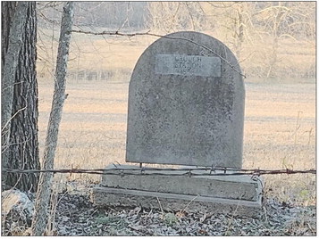
From Smith Station, the Butterfield mail coach traveled several more miles to the southwest, before making a second stop at Crouch Station, located alongside Flat Creek, about four miles northeast of Cassville. It’s difficult to spot, but the original 1858 Butterfield concrete marker is intact in the vicinity of Crouch Station. However, the actual location of the station, now long gone, was in question by the NPS team and their local guide, retired medical Dr. John Fahey, of Fayetteville, Ark., a member of the Butterfield Overland Trail Association.
Rick Boyer, of Virginia, who stopped by the office of the Cassville Democrat last December after reading the article “Scouting out The Trail” (https:// tinyurl.com/2ujp7r4v) in Through the Years Magazine – solved the mystery.
“I was born in the old Crouch Station house in 1952,” Boyer said. “The house was located across the road to the southeast from where the marker is located.”
His mother, Louise Leitner – of Wichita, Kan., formerly of Cassville – confirmed Boyer’s statement.
Confirmation also comes from railroad retiree and investigative cartographer Greg Wadley, of Springfield, who uses research from the United States Geological Survey’s (USGS’s) LIDAR to trace the Butterfield’s route through Missouri, and to then create maps based on his findings.
“The LIDAR showed evidence of the footings of a house across the road from the Crouch Station marker,” Wadley said.
Wadley provided preliminary Barry County trail information to Dr. Fahey, who served as the NPS’s tour guide during their November visit.
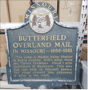
Local property owners, however, often know more about their properties’ history than what can be discovered by new technology. A mile south of Washburn, Jerry Ellis owns the site where Barry County’s third, final and southern-most Butterfield stage stop, Harbin Station, was located.
Ellis’ mother, Roberta Ellis, was a descendent of the Harbins, according to armchair historian, blogger and Butterfield trail-scouter Don Matt, of Berryville, Ark. Matt visited with Mrs. Ellis in person several years before her death a couple of years ago. Her son, who now owns the property where Harbin Station once stood, values privacy in the same manner as the Smith Station property owner.
“That’s okay,” said Angelica Sanchez-Clark. “The park service has different ways of partnering with private landowners. We respect property owners’ desire for privacy. We don’t go where we’re not welcome, nor do we put up signs without permission.”
However, Sanchez-Clark said an alternative to the posting of signs and interpretive wayside markers, might be the hosting of occasional public viewings of station sites – maybe once a year, for example — as a way of preserving history, and to give history buffs a peek into the past.
“I will be in Fayetteville, Ark., Dec. 16-19, to visit with Northwest Arkansas city planners about partnering with the NPS,” Sanchez-Clark said. “I hope to schedule a trip to another area afterward.”
Cassville, she said, is an area of interest.
More information about the local history of the Butterfield Overland Mail Route can be found at the Barry Couty Museum, in Cassville, at www.barrycomuseum. org, and on the National Park Service site at https://www.nps.gov/ buov/index.htm .
For more information about ways to partner with the NPS for the preservation and protection of the Butterfield Overland NHT in Barry County and beyond, including site certification, people may contact Angelica Sanchez-Clark at Angelica_ [email protected], or by calling 505-819-1350.

